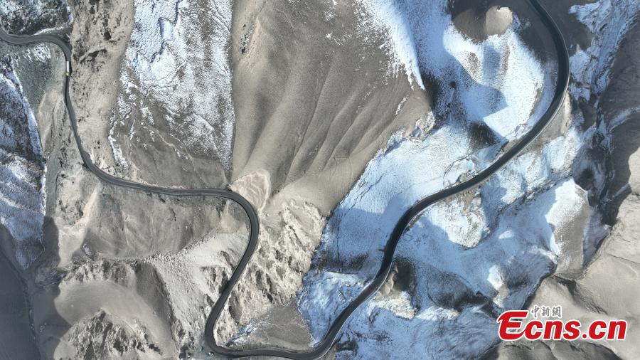
Aerial view shows the Xinjiang-Tibet Highway passing through mountains. As one of the world's highest motorable roads, Xinjiang-Tibet Highway, or China National Highway 219, connects northwest China's Xinjiang Uygur Autonomous Region and southwest China's Tibet Autonomous Region with an average altitude of over 4,500 meters. (Photo: China News Service/Sun Tingwen)
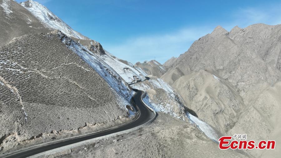
Aerial view shows the Xinjiang-Tibet Highway passing through mountains. As one of the world's highest motorable roads, Xinjiang-Tibet Highway, or China National Highway 219, connects northwest China's Xinjiang Uygur Autonomous Region and southwest China's Tibet Autonomous Region with an average altitude of over 4,500 meters. (Photo: China News Service/Sun Tingwen)

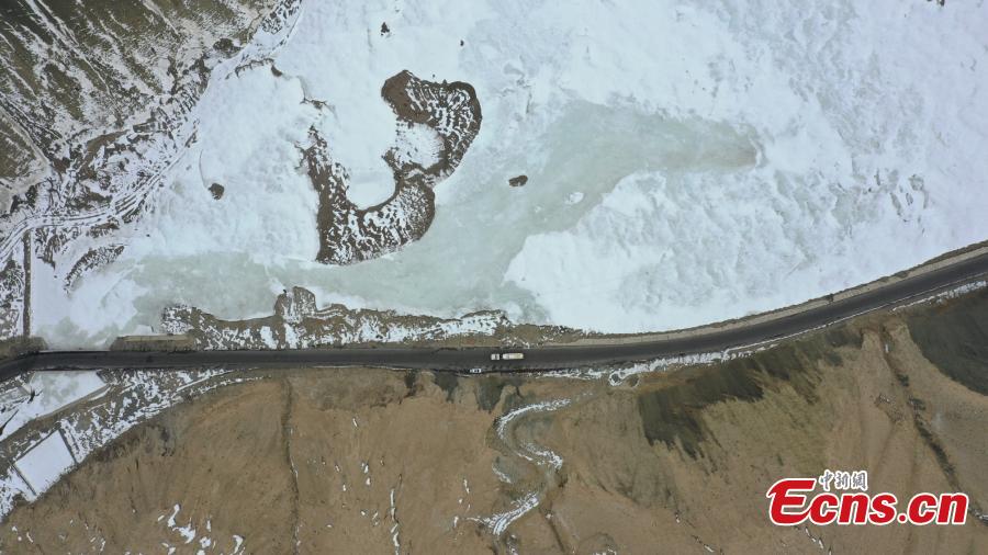
Aerial view shows the Xinjiang-Tibet Highway passing through mountains. As one of the world's highest motorable roads, Xinjiang-Tibet Highway, or China National Highway 219, connects northwest China's Xinjiang Uygur Autonomous Region and southwest China's Tibet Autonomous Region with an average altitude of over 4,500 meters. (Photo: China News Service/Sun Tingwen)
Aerial view shows the Xinjiang-Tibet Highway passing through mountains. As one of the world's highest motorable roads, Xinjiang-Tibet Highway, or China National Highway 219, connects northwest China's Xinjiang Uygur Autonomous Region and southwest China's Tibet Autonomous Region with an average altitude of over 4,500 meters. (Photo: China News Service/Sun Tingwen)
Aerial view shows the Xinjiang-Tibet Highway passing through mountains. As one of the world's highest motorable roads, Xinjiang-Tibet Highway, or China National Highway 219, connects northwest China's Xinjiang Uygur Autonomous Region and southwest China's Tibet Autonomous Region with an average altitude of over 4,500 meters. (Photo: China News Service/Sun Tingwen)


.png)